Panoramas
Herein lie lakeside panoramas. They are in two groups: in the first group each picture spans the full circle around the horizon (360° by 100°) and so the left and right edges join; in the second group the pictures only span about half the horizon (180° by 50°).
360° panoramas
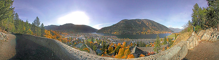 Nelson Panorama At Nelson, the West Arm narrows to form a river. In the centre is the city of Nelson, across the water is Nelson (a.k.a Elephant) Mountain, and bordering either side of the picture is the trees of Gyro Park. (360° view)'
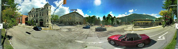 Vernon and Ward A view from the traffic island in the middle of Vernon Street. The buildings on the four corners are (from left to right): Museum, Hume Hotel, Courthouse, Credit Union. Traffic is light on this late summer afternoon. (360° view)'
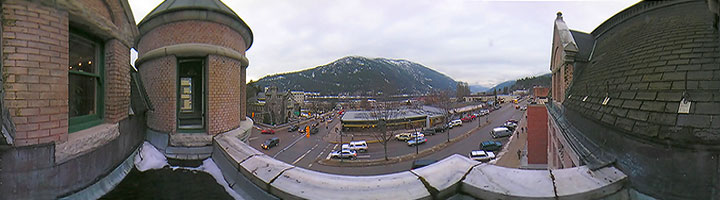 Museum view The building on the southeast corner of Vernon and Ward started life as a post office in 1902. In the 1950s it became a city hall, and in 2006 a museum. This is a view from the roof. (360° view)'
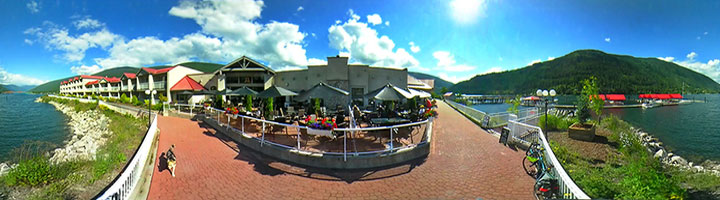 Lakeside walk A walkway extends along the Nelson shore from the Orange Bridge to Cottonwood Creek. Here it is passing the outdoor restaurant of the Prestige Inn. (360° view)'
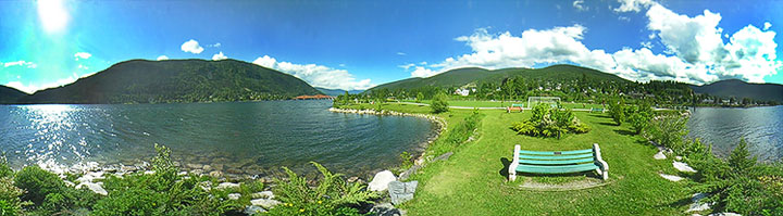 Park bench As the lakeside walkway passes some sports fields, there is a little peninsula with a park bench. (360° view)'
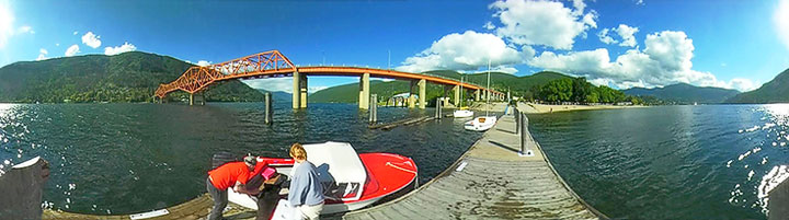 Boat launch Just to the west of the Orange Bridge there is a boat launch and small pier. This is view from the end of that pier. (360° view)'
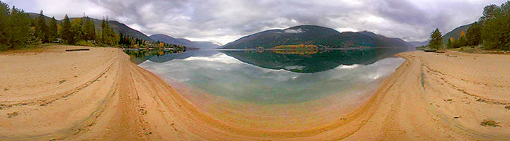 An autumnal view from the water’s edge at Shannon Point. Troup (Five-Mile Creek peninsula) lies across the Lake. (360° view)'
 Balfour Narrows The M.V. Osprey passes the Balfour dolphin on its way to the Main Lake (left); the Fraser Narrows are on the right in the distance. (360° view)'
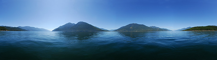 Three Arms Join The three arms of Kootenay Lake can be seen from the ferry, but, the best simultaneous view is from the water a bit west of the Pilot Bay Lighthouse. The peninsula on which the lighthouse sits spans the left and right edges of this panorama. Behind it are the Purcell Mountains. The South Arm is seen a quarter of the way from the left, the West Arm is in the centre, and the North Arm is a quarter of the way from the right. The Selkirk mountains extend across the centre of the picture on either side of the West Arm. (360° view)
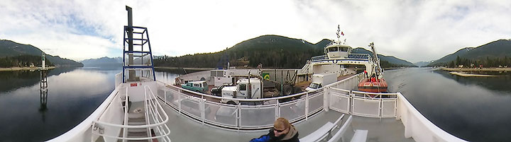
 Approaching Kootenay Bay The M.V. Osprey approaches the landing. (360° view)'
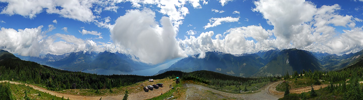 There is a road to the top of Mt. Buchanan (1909m). The edges of the picture are to the north and the centre to the south. The North Arm of Kootenay Lake and the Purcells are seen on the left. The Selkirks are spread across the right hand side. (360° view)'
180° panoramas
(more or less)
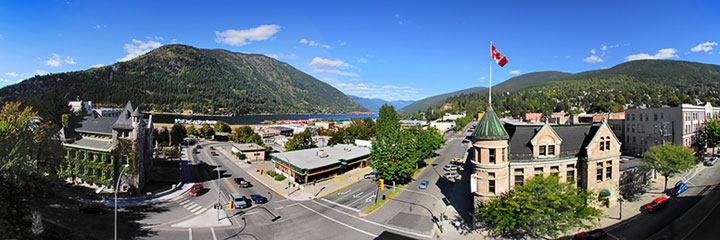 Touchstones Nelson, Museum of Art and History, is located in the 1902 Post Office building (flag). Kitty-corner, across the intersection of Ward and Vernon, is the ivy-covered 1909 Courthouse. (~230° view)
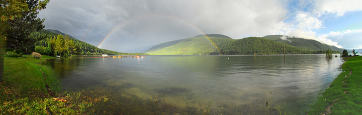 A rainbow over the West Arm. It is mid June and the water is high, covering beaches and lapping the lawns with driftwood. Lakeside life isn’t as much bucolic as it is sylvan. (>180° view)
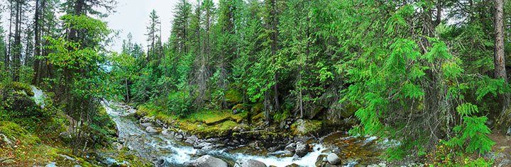 Kokanee Creek This picture was taken (in a very high-resolution version) for Touchstones Nelson’s exhibit on first peoples. (>180° view)
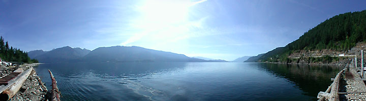
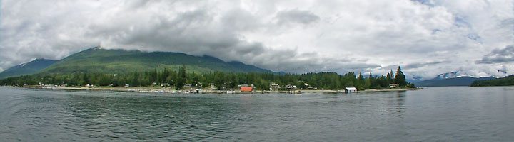 Balfour From the ferry terminal on the left to the narrows into the Main Lake on the right. (180° view)'
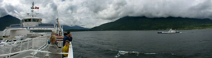 Passing The Osprey passes the M.V. Balfour in the Main Lake. (180° view)'
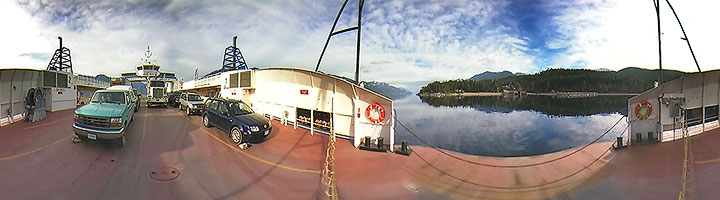
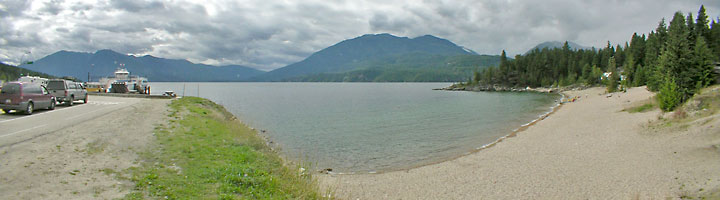 Kootenay Bay The M.V. Osprey loads vehicles at Kootenay Bay on the east side of the Main Lake. (180° view)'
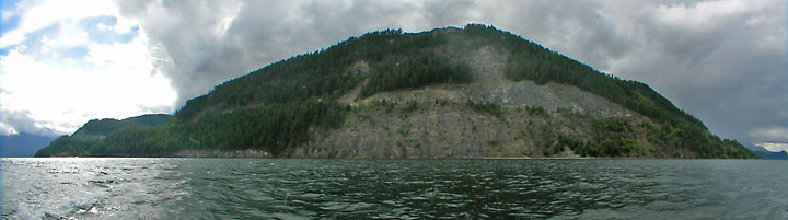 Coffee Creek Bluffs The road from Balfour to Ainsworth climbs high over the Lake. (180° view)'
 Woodbury Creek Looking south from the Jones Boys Marina. (180° view)'
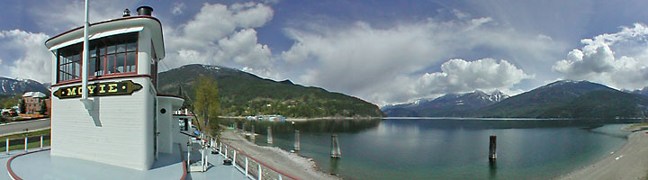 Kaslo Bay The bay is seen from the top deck of the S.S. Moyie. (180° view)'
![]()