Cirrus
Cirrus is rather loosely defined as a high cloud, particularly one made up of ice crystals and looking rather diffuse. The name itself means a lock of hair, and fairly clearly derives from a particular form of cirrus, that of the cirrus uncinus—meaning a hook shaped lock of hair, a cloud which also goes by the names: mare’s tails, and fallstreaks.
When the term, cirrus, is used, a meteorologist immediately thinks of a cloud composed of ice crystals rather than water drops. And while other clouds do contain ice—thunderstorms, ice fog—ice crystals are the central feature of cirrus. Some observable features of cirrus, then, only become understandable with a little knowledge of the behaviour of ice in our atmosphere:
• Freezing When a cloud forms at temperatures below 0°C, it normally begins with water droplets, rather than ice crystals. What happens next depends (largely) upon the temperature. At higher temperatures in the range -40°C to 0°C only a few droplets will freeze soon after cloud formation. At lower temperatures, almost all will.
• Crystal growth While water and ice can coexist at temperatures below 0°C, it isn’t an easy coexistence: crystals grow at the expense of droplets. This is owning to the fact that at the equilibrium vapour pressure for ice is less than that for water. At vapour pressures between these values, there is evapouration from the water and condensation on the ice. At higher temperatures, say -10°C to -25°C, where few ice crystals will have formed, each crystal will now be fed by vapour from myriad adjacent water drops, and so will grow quite large. This size gives it a larger terminal velocity than the adjacent drops and it quickly falls out of the initial cloud.
• Low temperatures If the water cloud high enough in the atmosphere that forms at temperatures approaching -40°C, all the drops freeze very quickly. Now the ice crystals do not benefit from an imbalance between the number of crystals and drops and so all crystals remain small. This produces diffuse sheets of cloud, which if the growth is slow may end up allowing spectacular haloes.
To this behaviour of ice is added some some dynamics which will help account for shapes.
• Secondary convection Sometimes the tops of fallstreaks seem to develop new cloudy tufts. The original cloud was water; as it froze, latent heat was released warming the air and giving it sufficient buoyancy to rise out of the original cloud and produce new cloud fragments.
Armed with these insights, we can make sense of much of the cirrus we see.
For some of the condensation mechanisms discussed below, it is useful to read: condensation.
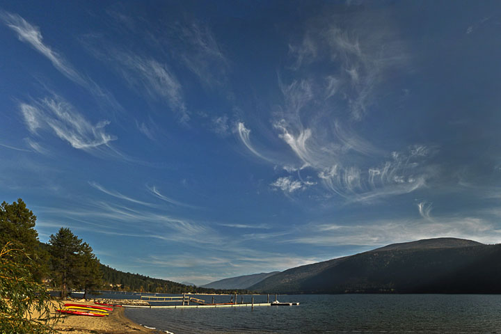 On an otherwise clear October day, fallstreaks hang in the sky high over the Lake.
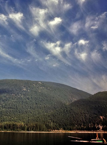 These August fallstreaks have not provided enough cloud to diminish the pleasure of swimmers.
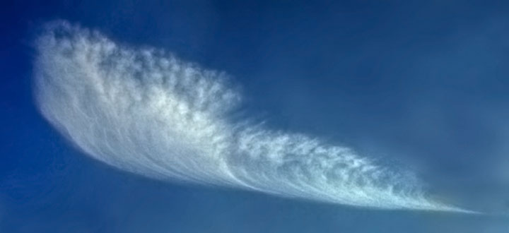
 A fallstreak starts when a small convective cloud of supercooled water droplets forms in ascending air aloft. When the temperature is quite low, say, less than -20°C some of the drops will then freeze. The resulting ice crystal will grow very rapidly by vapour diffusion and fall below the original cloud.
 Crystals keep falling out of the water cloud until all drops have frozen. Streaks, extending down hundreds of meters, will encounter different wind velocities so are spread horizontally. Unexpectedly, the streak assumes a parabolic shape in response to a constant (linear) change of wind with height.
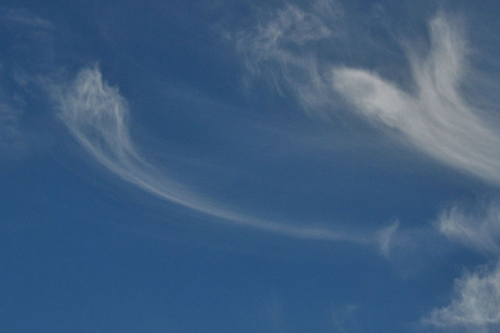
 This line of similar fallstreaks seems to be sprouting new turrets at the top, probably the result of the secondary convection arising from the latent heat of freezing.
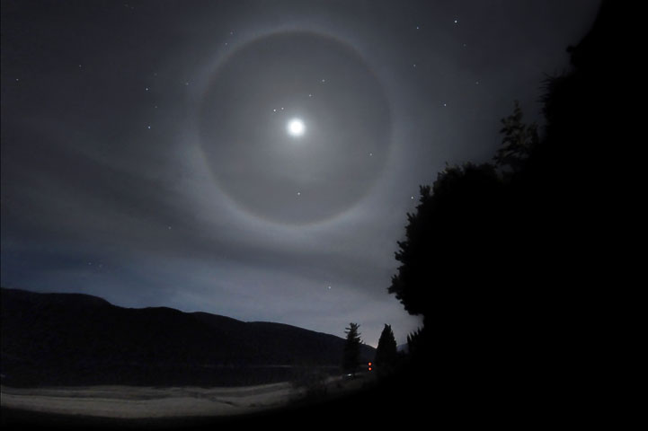 Slow ascent at low temperatures will produce myriad simple ice crystals, which can in turn produce various haloes. This picture of a halo around the moon is from the page on haloes.
![]()